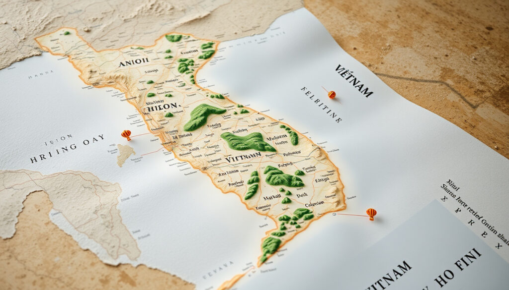
Map of Vietnam: Cities, Regions, Tourist Spots & Guide
Stretching over 1,650 kilometers along the eastern coast of the Indochinese Peninsula, Vietnam packs remarkable geographic diversity into a narrow S-shaped strip of land. Whether you’re plotting a weekend in Hanoi, dreaming of Ha Long Bay’s limestone pillars, or weighing the heat of Ho Chi Minh City against the mountains of Sapa, understanding the map is your first step to getting it right. Below is a guide to Vietnam’s cities, regions, and tourist highlights—organized around the questions travelers actually ask.
Capital: Hanoi · Largest City: Ho Chi Minh City · Total Area: 331,212 km² · Provinces: 34 (28 provinces and 6 municipalities) · Key Regions: North, Central, South
Quick snapshot
- Vietnam has 34 first-level subdivisions: 28 provinces and 6 municipalities (Wikipedia – Provinces of Vietnam)
- Hanoi is the capital city; Ho Chi Minh City is the largest city (GIS Geography – Vietnam Map)
- Halong Bay lies 170 km east of Hanoi and holds UNESCO World Heritage status (Asia Odyssey Travel – Vietnam Map)
- Subjective regional beauty rankings vary by traveler preference and season
- Comparative visitor numbers by region are not consistently published
- Exact ISO census dates for some province population figures remain unspecified
- Halong Bay recognized as UNESCO site in 1994 (Asia Odyssey Travel – Vietnam Map)
- Province consolidation reportedly began July 2025 (Vietnam Nomad – Map of Vietnam)
- Travel Vietnam maps last updated February 2022 (Travel Vietnam – Travel Maps)
- Read on for regional breakdowns, key cities, and tourist highlights across Vietnam’s three main regions
- Check the FAQ for travel timing, safety, and cultural tips
These figures anchor the core geographic data travelers need before planning routes between north and south.
| Fact | Detail |
|---|---|
| Capital City | Hanoi |
| Population | Over 98 million |
| Length | 1,650 km north-south |
| Neighboring Countries | China, Laos, Cambodia |
| Ho Chi Minh City Population | 14,002,598 |
| Ho Chi Minh City Area | 6,772.59 km² |
| Haiphong Population | 4,664,124 |
| Haiphong Area | 3,194.72 km² |
| An Giang Province Population | 4,952,238 |
| First-Level Subdivisions | 34 (28 provinces, 6 municipalities) |
Vietnam map with cities
A solid Vietnam map with cities marked gives you the lay of the land—literally. Vietnam’s urban network clusters along two main corridors: the Red River Delta in the north and the Saigon River basin in the south, with a thinner chain of cities strung along the central coast.
Major cities marked
- Hanoi (capital) — political and cultural hub of the north
- Ho Chi Minh City (largest city) — economic engine of the south, also called Saigon
- Haiphong — major port city in the Red River Delta
- Da Nang — central coast’s largest city and beach destination
- Can Tho — gateway to the Mekong Delta in the southwest
- Vung Tau — coastal retreat near Ho Chi Minh City
Vietnam’s urban geography follows its two great river systems. Travelers moving between Hanoi and Ho Chi Minh City will cross through three distinct climate and cultural zones—a journey that takes roughly 35 hours by road but reveals entirely different Vietnams along the way.
Hanoi and Ho Chi Minh City
Hanoi and Ho Chi Minh City anchor the country’s urban map like two ends of a seesaw. Hanoi holds 8.4 million residents in the cool north, its Old Quarter a centuries-old maze of lakes, temples, and street food stalls. Ho Chi Minh City dominates the south with 14 million people packed into a sprawling metropolis of French colonial facades, rooftop bars, and the chaotic energy of Southeast Asia’s largest urban economy.
Map of Vietnam North and South
The north-south divide shapes nearly everything about Vietnam—from climate and cuisine to the rhythm of daily life. Understanding these regions helps you choose where to spend your time and what to pack.
Northern Vietnam highlights
North Vietnam breaks into three subregions. The Northeast (Dong Bac) includes Cao Bang, Lang Son, and the karst landscapes of Ha Long Bay. The Northwest (Tay Bac) runs up into the mountains around Sapa and Dien Bien, where Ho Chi Minh’s final victory at Dien Bien Phu ended French colonization in 1954. The Red River Delta anchors the region with Hanoi at its center, ringed by provinces like Vinh Phuc, Hai Phong, and Bac Ninh.
Southern Vietnam highlights
South Vietnam splits into the Southeast (Dong Nam Bo) anchored by Ho Chi Minh City and the industrial provinces of Binh Duong and Dong Nai, and the Southwest (Dong Bang Song CuuLong), better known as the Mekong Delta. Thirteen provinces fan out across this river-drenched plain of floating markets, rice paddies, and coconut groves.
North Vietnam brings four distinct seasons—pack layers for winter (December through February), especially in the mountains. Central Vietnam is tropical and dry February through May, with rain likely October through December. South Vietnam stays hot year-round with a dry season from December through April.
6 places to visit from north to south
- Hanoi — temples, street food, Old Quarter walks
- Ha Long Bay — UNESCO-listed limestone islands, best seen by boat
- Hoi An — lantern-lit ancient town, tailors, rice fields
- Da Nang — beaches, the Marble Mountains, My Son ruins nearby
- Ho Chi Minh City — Cu Chi Tunnels, rooftop bars, Ben Thanh Market
- Mekong Delta — floating markets, orchards, homestays in Can Tho or Chau Doc
Detailed map of Vietnam
A detailed Vietnam map shows you more than dots on a page—it reveals the country’s physical bones: mountain ranges, river deltas, coastlines, and the provinces that organize daily governance.
Physical features
Vietnam’s topography runs steep from northwest to southeast. The Annamite Range (Truong Son) bisects the country from north to south, creating distinct weather patterns on either side. The Northern Highlands (Dong Bac) rise dramatically near the Chinese border, with peaks exceeding 3,000 meters. Three great river deltas—the Red River in the north, the Saigon River basin in the southeast, and the Mekong Delta in the southwest—account for most of Vietnam’s arable land and population density.
Road map details
National Route 1A runs the full 1,650-kilometer length of Vietnam from the Chinese border near Lao Cai down to Ca Mau at the southern tip of the Mekong Delta. The Vietnam War-era Ho Chi Minh Trail, now partly a modern highway, cuts inland through the Annamite foothills. Expressways connecting Hanoi to Haiphong (2019) and the planned Nhat Tan Bridge crossing show where infrastructure investment is concentrated.
Our North and South Vietnam map for tourism is an ultimate guide to effortlessly uncovering these paradisiacal havens.
— VinWonders (Tourism Guide)
Vietnam’s narrow shape—no point in the country lies more than 150 km from the coast—means the weather and terrain change faster than you might expect from north to south. A detailed map helps you avoid the mistake of packing for “tropical Vietnam” when you’re headed to Sapa in December.
Which part of Vietnam is most beautiful?
Beauty is subjective, but Vietnam offers three distinct visual palettes that draw different kinds of travelers. Here’s what each region delivers.
Northern beauty
The north rewards those who love drama. Ha Long Bay’s 1,600-plus limestone islands rising from emerald water is the image most travelers carry in their minds. Sapa’s terraced rice fields shift from green to gold with the seasons. Mountain passes like Maichau and Mu Cang Chai deliver valleys wrapped in mist. The French colonial hill station vibe of Sapa town adds a layer of weathered charm.
Central coast
Central Vietnam blends history with coastline. Hue’s Imperial Citadel and royal tombs sit beside Perfume Pagoda. Da Nang offers clean beaches and the Lady Buddha statue. Hoi An’s yellow-walled merchants’ houses glow under paper lanterns at night. Nha Trang delivers 30 km of beachfront backed by coral reefs. Dalat’s French colonial hillside villas, pine forests, and waterfalls offer a completely different visual register from the tropical coast below.
Southern deltas
The south trades dramatic karst for flowing water landscapes. The Mekong Delta’s maze of canals, floating markets, and pomelo orchards rewards slower travel. Phu Quoc Island brings tropical beaches and coral diving. The Mekong’s silt deposits create one of Asia’s most fertile agricultural regions—a living patchwork of rice paddies, fruit orchards, and stilt-house villages that changes character entirely from wet to dry season.
What is the number one tourist spot in Vietnam?
No single attraction draws more travelers than Ha Long Bay. This UNESCO World Heritage Site off the coast of Quang Ninh Province receives roughly 6 million visitors annually, with over 500,000 of those coming from international arrivals.
Top spot on the map
Ha Long Bay sits 170 kilometers east of Hanoi, accessible by road in roughly 4 hours or by seaplane in under an hour. The bay covers 1,553 square kilometers with 1,960 limestone islands and islets, many hollow with caves, many topped with jungle. Cruises range from day trips to overnight junk boats to luxury overnight vessels with kayaks and cave access.
Places to go
- Ha Long Bay — UNESCO site, limestone islands, boat cruises (4 hours from Hanoi)
- Hoi An — ancient town, lanterns, tailor shops, My Son nearby
- Hue — Imperial Citadel, Perfume Pagoda, royal tombs
- Sapa — trekking, ethnic minority villages, rice terraces
- Da Nang — beaches, Marble Mountains, Ba Na Hills
- Ho Chi Minh City — Cu Chi Tunnels, Reunification Palace, nightlife
- Mekong Delta — floating markets, homestays, cycling trails
- Phu Quoc — island beaches, snorkeling, Vinpearl Safari
Ha Long Bay’s popularity has a cost: weekend boat congestion, overdevelopment on Cat Ba Island, and environmental pressure on the limestone ecosystem. Travelers seeking similar scenery with fewer crowds might consider Lan Ha Bay (adjacent, quieter) or Phong Nha-Ke Bang’s cave systems inland.
Clarity on the map
Confirmed facts
- Capital and major cities fixed on maps: Hanoi, Ho Chi Minh City, Da Nang, Haiphong, Can Tho, Vung Tau
- First-level subdivisions: 34 units (28 provinces, 6 municipalities)
- Ho Chi Minh City: 14,002,598 residents across 6,772.59 km²
- Haiphong: 4,664,124 residents across 3,194.72 km²
- Halong Bay: 170 km east of Hanoi, UNESCO site since 1994
- Three climate zones: North (4 seasons), Central (tropical dry/wet), South (hot year-round)
What’s rumored or unclear
- Administrative consolidation from 63 to 34 provinces—reported for July 2025 but not independently verified
- Exact census dates for population figures vary by province source
- Comparative tourism visitor numbers by region not publicly available
- Interactive map APIs and downloadable coordinate files remain fragmented across sources
What travelers say
Hanoi: The heart of the north. Experience the Old Quarter, Hoan Kiem Lake, Temple of Literature, and vibrant street food scene.
— GIS Geography (Map Resource)
Most travelers start in Ho Chi Minh City (HCMC). South Vietnam combines bustling city life, lush Mekong Delta, and beach destinations.
— Travel Vietnam (Travel Guide)
North Vietnam: 4 seasons, cool winters. Best for culture, nature, trekking. Recommended stay: 5–7 days.
— Deluxe Vietnam Tours (Tour Operator)
Vietnam’s compact size—1,650 km north to south—makes multi-region trips feasible, but the terrain means travel times can surprise you. A Hanoi–Da Nang flight takes 90 minutes; a road journey the same route stretches to 14 hours. Budget your transit time realistically or you’ll lose days chasing connections instead of seeing sights.
Travelers consistently underestimate distances along National Route 1A, which snakes through mountain passes and coastal curves rather than cutting straight. The north-south divide isn’t just cultural—it’s a factor in flight pricing, weather windows, and how much you can fit into a week.
Summary
Vietnam rewards the prepared traveler. Understanding the map first—knowing where Hanoi sits relative to the delta, how the three climate zones stack up, which regions are compact and which demand time—means your itinerary matches your available days. The north offers cultural richness and cool air; the central coast delivers history and beaches within easy reach; the south throws you into urban energy and river delta life. For travelers, the choice isn’t about picking one region over another—it’s about sequencing them in an order that fits your travel style and calendar.
Related reading: North and South Vietnam map · Vietnam map
vietnamnomad.com, asiaphotos.org, deluxevietnamtours.com, worldtraderef.com
Vietnam’s latest administrative map reflects mergers into 34 provinces and cities, as detailed in the post-merger Vietnam province map alongside key spots like Hanoi.
Frequently asked questions
What is the weather like in different parts of Vietnam?
North Vietnam has four seasons—cool winters (December–February) with temperatures sometimes dropping below 10°C in the mountains. Central Vietnam is tropical with a dry season February–May (25–30°C) and wet season October–December. South Vietnam stays hot year-round (28–35°C) with a dry window December–April.
What are common mistakes tourists make in Vietnam?
Underestimating travel distances is the biggest one. The road from Hanoi to Ho Chi Minh City is 1,730 km by the most direct route—longer if you’re following scenic back roads. Other frequent mistakes: packing only tropical clothes for a northern winter trip, skipping advance booking during Tet (Lunar New Year), and assuming English is widely spoken outside major cities.
Is it safe for tourists in Vietnam?
Vietnam ranks among the safer destinations in Southeast Asia for violent crime. Common-sense precautions apply: watch for traffic (the leading cause of injury), guard belongings in crowded markets, and avoid political demonstrations. Road traffic remains the primary safety concern for most travelers.
What should tourists not bring to Vietnam?
Vietnam has strict rules on bringing in certain items: more than 10,000 USD in cash must be declared; restricted medications require a prescription in Vietnamese; religious materials over certain quantities need approval. Online gambling and cryptocurrency restrictions have tightened—check current customs regulations before travel.
How to avoid mosquitoes in Vietnam?
Mosquitoes are most active during rainy season (May–October) in the south and delta regions. Use DEET-based repellent in the evening, sleep under nets in rural areas, and wear long sleeves at dusk. Dengue fever is present in Vietnam—there’s no vaccine for the currently circulating strains, so prevention through bite avoidance matters.
What cultural gestures to know in Vietnam?
Pass items with both hands or the right hand. Avoid pointing your feet at people or altars—feet are considered the lowest part of the body. The head is sacred; don’t pat children on the head. Tipping is not traditional but appreciated in tourist areas. Bargaining is expected at markets but not in restaurants or stores with fixed prices.
When is the best time to visit Vietnam?
It depends on which region: October–November works for the north (post-monsoon, cool), February–April for the central coast (dry, warm), and December–April for the south (dry season, hot). Avoid Tet (Lunar New Year, late January or February) if you want businesses open. The country stretches 1,650 km north to south, so there’s almost always a good window somewhere.
More related posts
 Hains and Co Adelaide: Menu, Reviews & Whisky Bar Guide
 Bank of Australia: Ownership, History & Top Banks Guide
 5 Foot 2 in CM – Exact Conversion to 157.48 cm
 19 Billion Compromised Passwords: The 2025 Mega-Leak Explained
 Shingles Vaccine Side Effects: Common Reactions and Duration
 Categoría Primera A Standings: Live Table & Results
 Airpod 4 Case – Best Protection and Value Options
 Dairy Milk Chocolate: Facts, Myths, Prices & Health Info